Apogeo Spatial
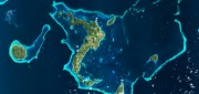
Imagery Options for Esri Users. Esri’s ArcGIS Marketplace
December 29, 2014
IS users increasingly expect content to come with their platform, rather than be an add-on. To help meet this expectation,...
December 29, 2014
IS users increasingly expect content to come with their platform, rather than be an add-on. To help meet this expectation,...
Mapping People: Human Landscape
August 12, 2014
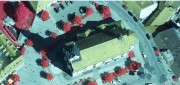
The executive director of an international nonprofit organization needs to map all the hospitals, clinics, and first aid facilities...
August 12, 2014
The executive director of an international nonprofit organization needs to map all the hospitals, clinics, and first aid facilities...

Skybox: First Video from Space
May 31, 2014
AO: What is Skybox Imaging? SKYBOX: Skybox is a data and analysis company that extracts information from satellite imagery....
May 31, 2014
AO: What is Skybox Imaging? SKYBOX: Skybox is a data and analysis company that extracts information from satellite imagery....
Lidar Innovations: Software Catching Up, Alternative Technologies Emerge
February 24, 2014
Throughout its history, lidar has been one of the very few technologies in which the exponential growth in the hardware’s...
February 24, 2014
Throughout its history, lidar has been one of the very few technologies in which the exponential growth in the hardware’s...

Measuring Distant Winds: Remote Sensing for Siting Wind Turbines
July 8, 2013
Wind's contribution to energy production in the United States continues to grow. In 2011, it represented a third of all new electric...
July 8, 2013
Wind's contribution to energy production in the United States continues to grow. In 2011, it represented a third of all new electric...