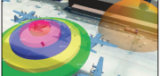
Photogrammetry
Automating the Mundane
January 19, 2017
You don’t have to work for huge organizations, such as the U.S. Air Force or the U.S. Forest Service, to appreciate the benefits...
January 19, 2017
You don’t have to work for huge organizations, such as the U.S. Air Force or the U.S. Forest Service, to appreciate the benefits...

Geospatial Solutions: from PIXIA, Luciad, and BAE Systems
October 10, 2016
This series began a year ago by examining alternatives to Google Earth Enterprise, which Google will stop supporting on March...
October 10, 2016
This series began a year ago by examining alternatives to Google Earth Enterprise, which Google will stop supporting on March...

Data Management & Visualization: Married Or Separated?
March 21, 2016
Large users of geospatial data are searching for alternatives to Google Earth Enterprise (GEE), which Google will discontinue...
March 21, 2016
Large users of geospatial data are searching for alternatives to Google Earth Enterprise (GEE), which Google will discontinue...

Developing the Map of the Future
April 9, 2015
Geospatial technology is changing. Now geographic information system (GIS) software is ingesting, organizing and visualizing...
April 9, 2015
Geospatial technology is changing. Now geographic information system (GIS) software is ingesting, organizing and visualizing...
From Traditional Photogrammetry to UAS
October 15, 2014
Photogrammetry has changed substantially in the past three decades. When Jeff Yates began in the business 32 years ago,...
October 15, 2014
Photogrammetry has changed substantially in the past three decades. When Jeff Yates began in the business 32 years ago,...

Extraterrestrial Photogrammetry
July 8, 2014
On Earth, photogrammetrists can normally use manmade objects in their frame—such as a road of known width or a curb of known...
July 8, 2014
On Earth, photogrammetrists can normally use manmade objects in their frame—such as a road of known width or a curb of known...