Geospatial topics
New Markets for Satellite Imagery
October 15, 2014
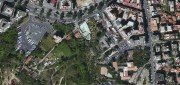
In June, the U.S. Department of Commerce, granting a request by DigitalGlobe, gave the company permission to sell its imagery...
October 15, 2014
In June, the U.S. Department of Commerce, granting a request by DigitalGlobe, gave the company permission to sell its imagery...
From Traditional Photogrammetry to UAS
October 15, 2014
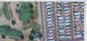
Photogrammetry has changed substantially in the past three decades. When Jeff Yates began in the business 32 years ago,...
October 15, 2014
Photogrammetry has changed substantially in the past three decades. When Jeff Yates began in the business 32 years ago,...
Mapping People: Human Landscape
August 12, 2014
The executive director of an international nonprofit organization needs to map all the hospitals, clinics, and first aid facilities...
August 12, 2014
The executive director of an international nonprofit organization needs to map all the hospitals, clinics, and first aid facilities...

Extraterrestrial Photogrammetry
July 8, 2014
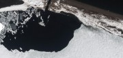
On Earth, photogrammetrists can normally use manmade objects in their frame—such as a road of known width or a curb of known...
July 8, 2014
On Earth, photogrammetrists can normally use manmade objects in their frame—such as a road of known width or a curb of known...

State of: Precision Agriculture
July 8, 2014
One of the fastest growing areas of application for geospatial technologies, precision agriculture is a way to optimize agricultural...
July 8, 2014
One of the fastest growing areas of application for geospatial technologies, precision agriculture is a way to optimize agricultural...

Going Beyond Global Forest Change Modeling Toward Big Earth-system Sustainability
July 7, 2014
One of the more impressive earth observation achievements in recent years was the collaboration between Google and the University...
July 7, 2014
One of the more impressive earth observation achievements in recent years was the collaboration between Google and the University...

Google Earth Outreach Continues Collaborations for Earth Modeling and Monitoring
June 10, 2014
Google Earth is all about putting things in geographic context, aiding literacy and helping users in discovery. This capacity...
June 10, 2014
Google Earth is all about putting things in geographic context, aiding literacy and helping users in discovery. This capacity...
Skybox: First Video from Space
May 31, 2014
AO: What is Skybox Imaging? SKYBOX: Skybox is a data and analysis company that extracts information from satellite imagery....
May 31, 2014
AO: What is Skybox Imaging? SKYBOX: Skybox is a data and analysis company that extracts information from satellite imagery....

UNEP Takes Advantage of Today’s Technology for Better and Cheaper Monitoring
May 28, 2014
The United Nations Environment Program is responsible for assisting countries in the collection of environmental data for more...
May 28, 2014
The United Nations Environment Program is responsible for assisting countries in the collection of environmental data for more...
Improving Global Carbon Estimates with LiDAR
May 13, 2014
International efforts to mitigate climate change hinge on limiting global anthropogenic CO2 emissions. About 12 percent of these...
May 13, 2014
International efforts to mitigate climate change hinge on limiting global anthropogenic CO2 emissions. About 12 percent of these...