Satellite navigation

Advancing GNSS, Full Interview
May 16, 2016
Interview with Septentrio’s Business Development Manager, Jan Van Hees, and R&D Director, Bruno Bougard Septentrio...
May 16, 2016
Interview with Septentrio’s Business Development Manager, Jan Van Hees, and R&D Director, Bruno Bougard Septentrio...
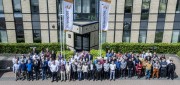
ADVANCING GNSS: A profile of Septentrio
March 7, 2016
Septentrio makes high-precision GNSS receivers for commercial and scientific applications. Its origins are in European space...
March 7, 2016
Septentrio makes high-precision GNSS receivers for commercial and scientific applications. Its origins are in European space...

Satellite Signals Steer Farmers Straight
December 29, 2014
Precision agriculture combines GPS, remote sensing, and GIS to capture large amounts of georeferenced data on spatial variations...
December 29, 2014
Precision agriculture combines GPS, remote sensing, and GIS to capture large amounts of georeferenced data on spatial variations...