Remote sensing

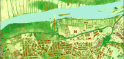
Moving Forward with UAS Mapping
June 16, 2015
For geospatial professionals, the most exciting aspect of the current explosion in unmanned aircraft systems (UASs) is using...
June 16, 2015
For geospatial professionals, the most exciting aspect of the current explosion in unmanned aircraft systems (UASs) is using...
Sensor Fusion: Deriving Information from Data
April 9, 2015
The current explosion in the variety, capability and sheer number of sensors is generating a flood of data intended to enhance...
April 9, 2015
The current explosion in the variety, capability and sheer number of sensors is generating a flood of data intended to enhance...

Developing the Map of the Future
April 9, 2015
Geospatial technology is changing. Now geographic information system (GIS) software is ingesting, organizing and visualizing...
April 9, 2015
Geospatial technology is changing. Now geographic information system (GIS) software is ingesting, organizing and visualizing...
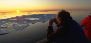
Monitoring Polar Changes: Scientists Deploy Many Tools to Measure Sea Ice Thickness
December 29, 2014
The extent of the polar ice caps is shrinking. This simple fact has been common knowledge since the late 1970s thanks to the added...
December 29, 2014
The extent of the polar ice caps is shrinking. This simple fact has been common knowledge since the late 1970s thanks to the added...
Imagery Options for Esri Users. Esri’s ArcGIS Marketplace
December 29, 2014
IS users increasingly expect content to come with their platform, rather than be an add-on. To help meet this expectation,...
December 29, 2014
IS users increasingly expect content to come with their platform, rather than be an add-on. To help meet this expectation,...
Mobile System Alerts Dubai Drivers of Approaching Sandstorms
October 16, 2014
Periodically, large sandstorms and low-visibility conditions wreak havoc in the Middle East, with potentially deadly consequences...
October 16, 2014
Periodically, large sandstorms and low-visibility conditions wreak havoc in the Middle East, with potentially deadly consequences...
New Markets for Satellite Imagery
October 15, 2014
In June, the U.S. Department of Commerce, granting a request by DigitalGlobe, gave the company permission to sell its imagery...
October 15, 2014
In June, the U.S. Department of Commerce, granting a request by DigitalGlobe, gave the company permission to sell its imagery...

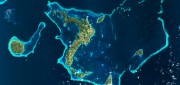
Going Beyond Global Forest Change Modeling Toward Big Earth-system Sustainability
July 7, 2014
One of the more impressive earth observation achievements in recent years was the collaboration between Google and the University...
July 7, 2014
One of the more impressive earth observation achievements in recent years was the collaboration between Google and the University...

Google Earth Outreach Continues Collaborations for Earth Modeling and Monitoring
June 10, 2014
Google Earth is all about putting things in geographic context, aiding literacy and helping users in discovery. This capacity...
June 10, 2014
Google Earth is all about putting things in geographic context, aiding literacy and helping users in discovery. This capacity...

UAS for Agriculture, Ready for Take-off
February 26, 2014
Unmanned aerial systems (UAS) have recently become ubiquitous in the mass media and in trade publications, due to a variety...
February 26, 2014
Unmanned aerial systems (UAS) have recently become ubiquitous in the mass media and in trade publications, due to a variety...