Item type

Radiant.Earth
November 6, 2018
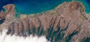
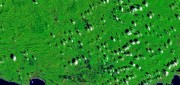
Nonprofits working on global development issues have had great difficulty acquiring and using a staple source of geospatial...
November 6, 2018
Nonprofits working on global development issues have had great difficulty acquiring and using a staple source of geospatial...
Companies Apply Machine Learning for Ag
March 6, 2018
The shift in the Earth observation (EO) market from selling pixels to selling finished intelligence products has sharply...
March 6, 2018
The shift in the Earth observation (EO) market from selling pixels to selling finished intelligence products has sharply...

Easing the 3D Workflow
February 19, 2018
For 30 years, an Alaska-based company has been producing digital mapping and photogrammetic software to help automate the complex...
February 19, 2018
For 30 years, an Alaska-based company has been producing digital mapping and photogrammetic software to help automate the complex...
Shifting Ground: GNSS for Earthquakes
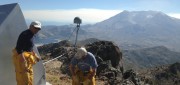
February 19, 2018
This is the third article in a series in xyHt introducing readers to scientists and technologists who work in pursuit of early-warning...
February 19, 2018
This is the third article in a series in xyHt introducing readers to scientists and technologists who work in pursuit of early-warning...
Integrated UAV + Lidar Solutions
February 19, 2018
LiDAR has been around since the early 1960s. In recent years, it has emerged as a key geospatial remote sensing technology:...
February 19, 2018
LiDAR has been around since the early 1960s. In recent years, it has emerged as a key geospatial remote sensing technology:...

Managing Canada’s Data
February 7, 2018
From mapping utility poles to mapping radio frequency signal leaks, this company collects and manages much of the country’s...
February 7, 2018
From mapping utility poles to mapping radio frequency signal leaks, this company collects and manages much of the country’s...
Geospatial Analytics-as-a-Service & Platforms
February 7, 2018
The field of Earth Observation (EO) has seen two big changes in recent years: first, the massive increase in the number and variety...
February 7, 2018
The field of Earth Observation (EO) has seen two big changes in recent years: first, the massive increase in the number and variety...

The Future of GPS
October 4, 2017
More than half a century after a study by The Aerospace Corporation first laid out the design options for it, the Global...
October 4, 2017
More than half a century after a study by The Aerospace Corporation first laid out the design options for it, the Global...
Open Source GEOSPATIAL SOFTWARE
October 4, 2017
Open source geospatial software—spatial data management, GIS, and related developer tools and end-user applications delivered...
October 4, 2017
Open source geospatial software—spatial data management, GIS, and related developer tools and end-user applications delivered...
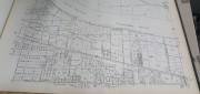
Recording, Registration, and Cadastres
September 18, 2017
An accurate and up-to-date record of property boundaries is essential for administering property taxes, enforcing environmental...
September 18, 2017
An accurate and up-to-date record of property boundaries is essential for administering property taxes, enforcing environmental...