Feature articles

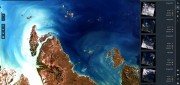
Integrated UAV + Lidar Solutions
February 19, 2018
LiDAR has been around since the early 1960s. In recent years, it has emerged as a key geospatial remote sensing technology:...
February 19, 2018
LiDAR has been around since the early 1960s. In recent years, it has emerged as a key geospatial remote sensing technology:...

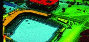
Managing Canada’s Data
February 7, 2018
From mapping utility poles to mapping radio frequency signal leaks, this company collects and manages much of the country’s...
February 7, 2018
From mapping utility poles to mapping radio frequency signal leaks, this company collects and manages much of the country’s...
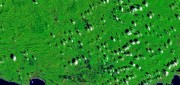
Geospatial Analytics-as-a-Service & Platforms
February 7, 2018
The field of Earth Observation (EO) has seen two big changes in recent years: first, the massive increase in the number and variety...
February 7, 2018
The field of Earth Observation (EO) has seen two big changes in recent years: first, the massive increase in the number and variety...

The Future of GPS
October 4, 2017
More than half a century after a study by The Aerospace Corporation first laid out the design options for it, the Global...
October 4, 2017
More than half a century after a study by The Aerospace Corporation first laid out the design options for it, the Global...
Open Source GEOSPATIAL SOFTWARE
October 4, 2017
Open source geospatial software—spatial data management, GIS, and related developer tools and end-user applications delivered...
October 4, 2017
Open source geospatial software—spatial data management, GIS, and related developer tools and end-user applications delivered...
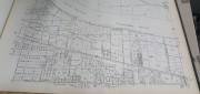
Recording, Registration, and Cadastres
September 18, 2017
An accurate and up-to-date record of property boundaries is essential for administering property taxes, enforcing environmental...
September 18, 2017
An accurate and up-to-date record of property boundaries is essential for administering property taxes, enforcing environmental...
FINAL ARTICLE IN THE SERIES on Geospatial Processing & Visualization: Ubisense and Harris Geospatial Solutions
August 4, 2017
The line between vendors of geospatial software and providers of geospatial data is increasingly blurred, as more companies...
August 4, 2017
The line between vendors of geospatial software and providers of geospatial data is increasingly blurred, as more companies...
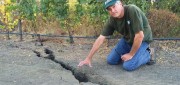
Shifting Ground: USGS on Earth Movement after an Earthquake
June 29, 2017
Ken Hudnut, science advisor for risk reduction, US Geological Survey, talks GPS and earthquakes Editor’s note: In many...
June 29, 2017
Ken Hudnut, science advisor for risk reduction, US Geological Survey, talks GPS and earthquakes Editor’s note: In many...
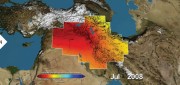
Satellite Missions Improve Water Estimates
April 28, 2017
Fresh water is humanity’s single most critical resource. According to a recent United Nations report, stresses on water...
April 28, 2017
Fresh water is humanity’s single most critical resource. According to a recent United Nations report, stresses on water...

Neutrino Beam! Scanning a Ring Tunnel
April 17, 2017
The surveying challenges for construction related to a particle accelerator are exacting—but surprisingly familiar. Trillions...
April 17, 2017
The surveying challenges for construction related to a particle accelerator are exacting—but surprisingly familiar. Trillions...