Geospatial topics

Precision agriculture grows with RTK
October 1, 2020
Precision agriculture — the practice of optimizing inputs of seed, water, and fertilizers while maximizing yields by mapping...
October 1, 2020
Precision agriculture — the practice of optimizing inputs of seed, water, and fertilizers while maximizing yields by mapping...

Antennas alert: Manufacturers discuss challenges and innovations
October 1, 2020
While often an underestimated component of a positioning and navigation system, a GNSS antenna is critical to a receiver’s...
October 1, 2020
While often an underestimated component of a positioning and navigation system, a GNSS antenna is critical to a receiver’s...
Receiver innovators log trends and product launches — Part 2
October 1, 2020
In the second part of our receiver feature, top receiver manufacturers discuss what’s on the horizon for GNSS receivers:...
October 1, 2020
In the second part of our receiver feature, top receiver manufacturers discuss what’s on the horizon for GNSS receivers:...

Research Roundup: Focus on maritime
October 1, 2020
Of the 273 papers researchers presented this year at the Institute of Navigation’s annual ION GNSS+ conference, which took...
October 1, 2020
Of the 273 papers researchers presented this year at the Institute of Navigation’s annual ION GNSS+ conference, which took...

Access denied: Anti-jam technology mitigates navigation warfare threats
October 1, 2020
GPS signals are by far the single most widely used and most accurate source of navigation, positioning and timing (PNT),...
October 1, 2020
GPS signals are by far the single most widely used and most accurate source of navigation, positioning and timing (PNT),...

Soft information for IoT positioning
October 1, 2020
The billions of interconnected devices and sensors embedded in other devices, vehicles and even humans that collectively...
October 1, 2020
The billions of interconnected devices and sensors embedded in other devices, vehicles and even humans that collectively...

NAVIGATING TESTING OPTIONS: Simulator Innovators Map Out Solutions & Trends
September 24, 2020
The number of GNSS signals, the frequency and sophistication of intentional and unintentional threats to those signals,...
September 24, 2020
The number of GNSS signals, the frequency and sophistication of intentional and unintentional threats to those signals,...

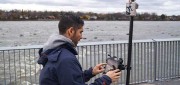
Accuracy with a Phone?
September 27, 2019
Photogrammetry is now possible using consumer devices, and the applications are vast. Continuing improvement in digital...
September 27, 2019
Photogrammetry is now possible using consumer devices, and the applications are vast. Continuing improvement in digital...

NASA’s Eyes on Mars
September 27, 2019
An old imaging technology is outdated for use on Earth, but it’s the perfect fit for today’s remote-sensing needs on Mars. Since...
September 27, 2019
An old imaging technology is outdated for use on Earth, but it’s the perfect fit for today’s remote-sensing needs on Mars. Since...

UAV Stakes Out New Ground
September 27, 2019
A flying/staking robot has taken a huge step forward in automation for site layout, including road, rail, utilities, and energy...
September 27, 2019
A flying/staking robot has taken a huge step forward in automation for site layout, including road, rail, utilities, and energy...