Satellite imaging

Planet Labs: Democratizing the Data of Earth, Daily
May 16, 2016
THE ADVENT OF MASS-PRODUCED, MINIATURE satellites is radically changing Earth observation by vastly increasing the imagery’s...
May 16, 2016
THE ADVENT OF MASS-PRODUCED, MINIATURE satellites is radically changing Earth observation by vastly increasing the imagery’s...
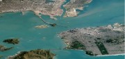
Companies Pick Up Where Google Earth Enterprise Leaves off
May 16, 2016
The waves created by Google’s announcement that it will stop supporting Google Earth Enterprise (GEE) in the spring of 2017...
May 16, 2016
The waves created by Google’s announcement that it will stop supporting Google Earth Enterprise (GEE) in the spring of 2017...
Data Management & Visualization: Married Or Separated?
March 21, 2016
Large users of geospatial data are searching for alternatives to Google Earth Enterprise (GEE), which Google will discontinue...
March 21, 2016
Large users of geospatial data are searching for alternatives to Google Earth Enterprise (GEE), which Google will discontinue...
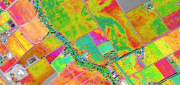
Satellite Imagery for Precision Agriculture
March 13, 2016
Precision agriculture consists primarily of using geospatial technologies to map spatial variations in crop and soil conditions...
March 13, 2016
Precision agriculture consists primarily of using geospatial technologies to map spatial variations in crop and soil conditions...
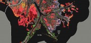
Wetlands Worth their Weight
March 2, 2016
"Wetland" is a generic term covering a wide variety of habitats that are wet for at least some period of time each year,...
March 2, 2016
"Wetland" is a generic term covering a wide variety of habitats that are wet for at least some period of time each year,...

The Demise of Google Earth Enterprise: VRICON AND ARCGIS EARTH FILL THE GAP
December 28, 2015
Google is ending a 10-year run of Google Earth Enterprise (GEE), which contributed greatly to the market for geospatial “Digital...
December 28, 2015
Google is ending a 10-year run of Google Earth Enterprise (GEE), which contributed greatly to the market for geospatial “Digital...
The Urgency of Building Bridges Between EO & Satcom
August 12, 2015
Currently, billions of individuals in every major world region— and billions of dollars worth of commerce—are supported...
August 12, 2015
Currently, billions of individuals in every major world region— and billions of dollars worth of commerce—are supported...

Satellite Imagery’s Impact
April 10, 2015
Unthreatened, aerial imaging/mapping companies embrace commercial satellite imagery's increased resolution Last June,...
April 10, 2015
Unthreatened, aerial imaging/mapping companies embrace commercial satellite imagery's increased resolution Last June,...

Maximizing the Sun: Solar energy grows in part due to aerial imaging and surveying
April 10, 2015
Solar power is booming in the United States. “Every three weeks,” President Obama said in his 2015 State of the Union...
April 10, 2015
Solar power is booming in the United States. “Every three weeks,” President Obama said in his 2015 State of the Union...

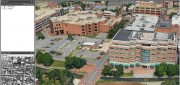
Developing the Map of the Future
April 9, 2015
Geospatial technology is changing. Now geographic information system (GIS) software is ingesting, organizing and visualizing...
April 9, 2015
Geospatial technology is changing. Now geographic information system (GIS) software is ingesting, organizing and visualizing...