Publications

Moving Forward with UAS Mapping
June 16, 2015
For geospatial professionals, the most exciting aspect of the current explosion in unmanned aircraft systems (UASs) is using...
June 16, 2015
For geospatial professionals, the most exciting aspect of the current explosion in unmanned aircraft systems (UASs) is using...

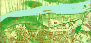
Mapping the Appalachian Trail (Part 1 of 2)
May 26, 2015
How the AT was created and surveyed, from Avery’s wheel to GPS The Appalachian Trail (AT) is very old, very long, and iconic....
May 26, 2015
How the AT was created and surveyed, from Avery’s wheel to GPS The Appalachian Trail (AT) is very old, very long, and iconic....

Navigating Without Addresses
April 10, 2015
New codes aim to bring billions of people into the geospatial market When we mail a letter to an address in an industrialized...
April 10, 2015
New codes aim to bring billions of people into the geospatial market When we mail a letter to an address in an industrialized...

Satellite Imagery’s Impact
April 10, 2015
Unthreatened, aerial imaging/mapping companies embrace commercial satellite imagery's increased resolution Last June,...
April 10, 2015
Unthreatened, aerial imaging/mapping companies embrace commercial satellite imagery's increased resolution Last June,...

Tracking Aircraft in Flight
April 10, 2015
The disappearance of Malaysia Airlines Flight 370 on March 8, 2014, with 239 people on board, was both tragic and stunning....
April 10, 2015
The disappearance of Malaysia Airlines Flight 370 on March 8, 2014, with 239 people on board, was both tragic and stunning....

Maximizing the Sun: Solar energy grows in part due to aerial imaging and surveying
April 10, 2015
Solar power is booming in the United States. “Every three weeks,” President Obama said in his 2015 State of the Union...
April 10, 2015
Solar power is booming in the United States. “Every three weeks,” President Obama said in his 2015 State of the Union...
Sensor Fusion: Deriving Information from Data
April 9, 2015
The current explosion in the variety, capability and sheer number of sensors is generating a flood of data intended to enhance...
April 9, 2015
The current explosion in the variety, capability and sheer number of sensors is generating a flood of data intended to enhance...

Developing the Map of the Future
April 9, 2015
Geospatial technology is changing. Now geographic information system (GIS) software is ingesting, organizing and visualizing...
April 9, 2015
Geospatial technology is changing. Now geographic information system (GIS) software is ingesting, organizing and visualizing...

Completing the Lake Wobegon Trail: Vision to Design
April 9, 2015
The urban areas in Stearns County, Minnesota, are like islands in a sea of corn, soybean and dairy farms. Through this bucolic...
April 9, 2015
The urban areas in Stearns County, Minnesota, are like islands in a sea of corn, soybean and dairy farms. Through this bucolic...

Real-Time Monitoring A Hit Down Under
January 11, 2015
In the heart of Brisbane, Australia’s third most populous city, constructioncompany Watpac Australia Pty. Ltd. has a contract...
January 11, 2015
In the heart of Brisbane, Australia’s third most populous city, constructioncompany Watpac Australia Pty. Ltd. has a contract...