• Home
  • About
    • About PBD
    • What Are Geospatial Technologies?
    • Matteo Luccio’s Bio
    • Conferences
    • Our Name
  • Topics
    • 3D imaging
    • Aerial photography
    • Bathymetry
    • Building Information Modeling (BIM)
    • CAD
    • Energy
    • Cadaster
    • Environment
    • Geodesy
    • GIS
    • LiDAR
    • Mapping
    • Navigation
    • Open source software
    • Other
    • Photogrammetry
    • Precision agriculture
    • Radar
    • Remote sensing
    • Satellite imaging
    • Satellite navigation
    • Seismology
    • Sensors
    • Surveying
    • UAS
    • Tracking
  • Magazines
    • Apogeo Spatial
    • ArcNews
    • ArcWatch
    • CE News
    • Earth Imaging Journal
    • GEOInformatics
    • GeoWorld
    • GIM International
    • Heights
    • Informed Infrastruct.
    • Imaging Notes
    • Point of Beginning
    • Prof. Surveyor Mag.
    • Sensors & Systems
    • Septentrio Insights
    • The American Surveyor
    • xyHt
  • Formats
    • Feature articles
    • Short articles
    • Interviews
    • News items
    • Other
  • All
  • Clients
  • Tips
    • Gripes
    • Tips
  • Contact Us
 

Comparing Maps a New Way

Posted by: Matteo    Tags:      Posted date:  February 21, 2017  |  No comment


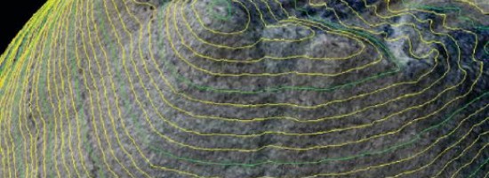
The positional accuracy of geospatial technologies has improved dramatically in the past few decades, and digital maps have replaced paper maps, making old ways of comparing maps obsolete.

Satellite and inertial positioning, aerial triangulation, lidar sensors and mobile mapping systems, interferometric synthetic aperture radar (IFSAR), unmanned aerial systems, and other key geospatial technologies have come a long way since the American Society for Photogrammetry and Remote Sensing (ASPRS) last revised its geospatial accuracy standards, more than 30 years ago. To catch up with the technology and fill a critical need for both map users and map makers, ASPRS recently released its new Positional Accuracy Standards for Digital Geospatial Data, available at asprs.org.

Traditionally, map users have relied on a map’s scale and contour interval as an indication of its accuracy, while map makers have relied on them to make diffi cult tradeoffs between accuracy and cost and to reliably and consistently describe their products.

Read more…


Want to say something?


  Cancel Reply


+ two = 7

« A Global Geodetic Roadmap
Mapping the Appalachian Trail (Part 2 of 2) »


Copyright (c) 2012 by Pale Blue Dot, LLC / For information write to matteo@palebluedotllc.com