Cadasta: Mapping Land Rights from the Bottom Up
Cadasta helps put people on the map with a cloud-based platform for land-ownership data.
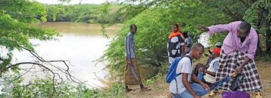
In advanced industrial countries we take much infrastructure for granted, such as cadastres with plots mapped at survey grade. In many countries, however, more than 70% of the land is outside the land register.
Most people among the world’s poor do not have any official record at all of their land rights. This facilitates mass encroachments on their land and illegal evictions. It also impedes development by preventing the poor from obtaining bank loans and government subsidies.
Cadasta Foundation, a nonprofit based in Washington, D.C., aims to empower people to claim their land rights by providing a cloud-based platform that they can use to collect, store, and analyze land-ownership data.
“It is about putting people, their rights, and their communities on the map, so that the benefits that come from more formal land rights extend to them as well,” says Noel Taylor, the organization’s co-founder and CEO.
Origins of Cadasta
Taylor is a land surveyor with a background in cadastral surveying and improving the cadastral infrastructure of developing countries. He worked for many years for International Land Systems, Inc. (ILS), on World Bank, USAID, and other development projects around the world.
“With pretty much all of those projects, there has been a strong focus on the appropriate use of technology,” he says.
A key challenge Taylor and his colleagues often faced was getting the initial data into the system, including people’s locations and their claims on land. The next challenge was helping governments improve the efficiency of their processes, increase their staff capacity, and make their systems–such as IT or geodetic infrastructure–sustainable. GPS and national-level geodetic systems figured heavily in many of these programs.