Feature articles
RADAR Gets It Done
June 1, 2010
Has anyone driven over certain desert dunes in Afghanistan during the past few hours? Is a ship on the high seas fishing...
June 1, 2010
Has anyone driven over certain desert dunes in Afghanistan during the past few hours? Is a ship on the high seas fishing...
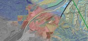
Rapid Response Mapping at Sanborn: Mapping Against the Clock
April 1, 2010
Early one morning in December 2005, the Taum Sauk Hydroelectric Plant Upper Reservoir, in the Missouri Ozarks, failed catastrophically,...
April 1, 2010
Early one morning in December 2005, the Taum Sauk Hydroelectric Plant Upper Reservoir, in the Missouri Ozarks, failed catastrophically,...

Beyond Terrain Models: LiDAR Enters the Geospatial Mainstream
February 1, 2010
First used by NASA in the mid-1980s, light detection and ranging (LiDAR) has become an essential complement to photogrammetry...
February 1, 2010
First used by NASA in the mid-1980s, light detection and ranging (LiDAR) has become an essential complement to photogrammetry...
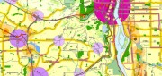
Portland, Oregon, Trailblazes a Successful Regional GIS
January 1, 2010
People from around the world come to Portland, Oregon, to study the city's successful model for growth management and comprehensive...
January 1, 2010
People from around the world come to Portland, Oregon, to study the city's successful model for growth management and comprehensive...

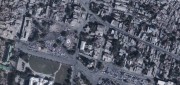
Remote Sensing by Remote Control: UAVs Become Invaluable Assets
October 1, 2009
When Somali pirates hijacked the U.S. freighter Maersk Alabama and took Capt. Richard Phillips hostage in April, a U.S. Navy...
October 1, 2009
When Somali pirates hijacked the U.S. freighter Maersk Alabama and took Capt. Richard Phillips hostage in April, a U.S. Navy...