• Home
  • About
    • About PBD
    • What Are Geospatial Technologies?
    • Matteo Luccio’s Bio
    • Conferences
    • Our Name
  • Topics
    • 3D imaging
    • Aerial photography
    • Bathymetry
    • Building Information Modeling (BIM)
    • CAD
    • Energy
    • Cadaster
    • Environment
    • Geodesy
    • GIS
    • LiDAR
    • Mapping
    • Navigation
    • Open source software
    • Other
    • Photogrammetry
    • Precision agriculture
    • Radar
    • Remote sensing
    • Satellite imaging
    • Satellite navigation
    • Seismology
    • Sensors
    • Surveying
    • UAS
    • Tracking
  • Magazines
    • Apogeo Spatial
    • ArcNews
    • ArcWatch
    • CE News
    • Earth Imaging Journal
    • GEOInformatics
    • GeoWorld
    • GIM International
    • Heights
    • Informed Infrastruct.
    • Imaging Notes
    • Point of Beginning
    • Prof. Surveyor Mag.
    • Sensors & Systems
    • Septentrio Insights
    • The American Surveyor
    • xyHt
  • Formats
    • Feature articles
    • Short articles
    • Interviews
    • News items
    • Other
  • All
  • Clients
  • Tips
    • Gripes
    • Tips
  • Contact Us
 

Portland, Oregon, Trailblazes a Successful Regional GIS

Posted by: Matteo    Tags:      Posted date:  January 1, 2010  |  No comment


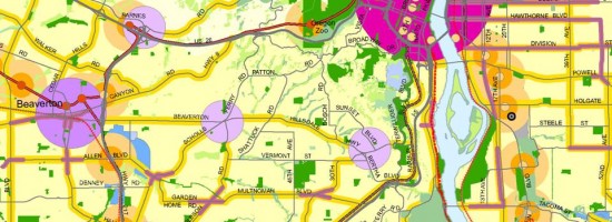
People from around the world come to Portland, Oregon, to study the city’s successful model for growth management and comprehensive land-use planning. Few, however, know that this success is enabled by a regional land information system (RLIS) that was conceived and implemented 20 years ago by Metro, the first elected regional government in the United States, along with cooperating local jurisdictions, to help meet state planning requirements. RLIS has since been the key tool used to plan, evaluate policy, and formulate development models in the Portland area.

Metro, which comprises three counties and 25 cities, secured the funding and political support required for the system, covering 544 square miles, through two visionary arrangements. First, it convinced the region’s electric utility company, PGE, to share its CAD file of tax lot boundaries. In return, Metro would return the file to PGE in GIS format and produce quarterly updates.

Second, Metro offered to share its system  with the cities and counties in its jurisdiction in exchange for their agreement to maintain the data and give Metro periodic updates. To gain support from Metro’s leadership, the project team quickly produced a map to demonstrate the system’s capabilities.

Read more…


Want to say something?


  Cancel Reply


three + 2 =

« Remote Sensing by Remote Control: UAVs Become Invaluable Assets
Beyond Terrain Models: LiDAR Enters the Geospatial Mainstream »


Copyright (c) 2012 by Pale Blue Dot, LLC / For information write to matteo@palebluedotllc.com