• Home
  • About
    • About PBD
    • What Are Geospatial Technologies?
    • Matteo Luccio’s Bio
    • Conferences
    • Our Name
  • Topics
    • 3D imaging
    • Aerial photography
    • Bathymetry
    • Building Information Modeling (BIM)
    • CAD
    • Energy
    • Cadaster
    • Environment
    • Geodesy
    • GIS
    • LiDAR
    • Mapping
    • Navigation
    • Open source software
    • Other
    • Photogrammetry
    • Precision agriculture
    • Radar
    • Remote sensing
    • Satellite imaging
    • Satellite navigation
    • Seismology
    • Sensors
    • Surveying
    • UAS
    • Tracking
  • Magazines
    • Apogeo Spatial
    • ArcNews
    • ArcWatch
    • CE News
    • Earth Imaging Journal
    • GEOInformatics
    • GeoWorld
    • GIM International
    • Heights
    • Informed Infrastruct.
    • Imaging Notes
    • Point of Beginning
    • Prof. Surveyor Mag.
    • Sensors & Systems
    • Septentrio Insights
    • The American Surveyor
    • xyHt
  • Formats
    • Feature articles
    • Short articles
    • Interviews
    • News items
    • Other
  • All
  • Clients
  • Tips
    • Gripes
    • Tips
  • Contact Us
 

After the Storm

Posted by: Matteo    Tags:      Posted date:  November 6, 2018  |  No comment


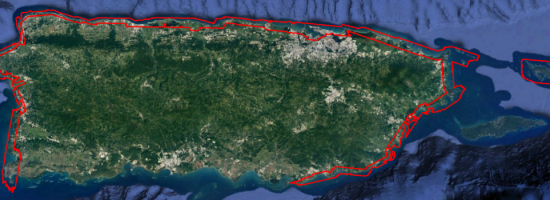
Post-hurricane coastal mapping is a complex process made easier with airborne bathymetry.

Lately, large storms such as hurricanes, cyclones, and typhoons have been wreaking havoc on coastal communities. Two Category 4 storms hit the United States in 2017, and one has made landfall so far in 2018.

These storms move so much sand and sediment around on the seafloor that they often make areas that were previously deep enough for navigation now several meters shallower, requiring new surveys before ships can safely traverse them.

These storms also create special logistical and technical challenges for surveyors. To overcome these challenges and help with disaster recovery, the U.S. Army Corps of Engineers (USACE) has been mapping coastal zones after hurricanes using airborne bathymetric lidar.

Read more…


Want to say something?


  Cancel Reply


nine − 1 =

« mESRIsoft
Street Views of the Water »


Copyright (c) 2012 by Pale Blue Dot, LLC / For information write to matteo@palebluedotllc.com