Item type
Building “Digital Earth”
February 23, 2017
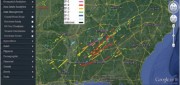
A new generation of geospatial intelligence helps to answer complex geographic questions Paper maps obsolesce rapidly from...
February 23, 2017
A new generation of geospatial intelligence helps to answer complex geographic questions Paper maps obsolesce rapidly from...

LIDAR Is Key To Autonomous Vehicles
February 23, 2017
Technology for autonomous vehicles builds on car navigation systems that have been commonplace for years and new collision-avoidance...
February 23, 2017
Technology for autonomous vehicles builds on car navigation systems that have been commonplace for years and new collision-avoidance...

Championing GNSS for Surveyors
February 21, 2017
Lonnie Sears’ passion for surveying began when he took a surveying class while studying engineering at West Virginia Tech....
February 21, 2017
Lonnie Sears’ passion for surveying began when he took a surveying class while studying engineering at West Virginia Tech....
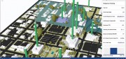
A State Gets Smart: SmarterBetterCities
February 21, 2017
To help formulate a 10-year strategic capital investment plan for the State of Oregon, the state’s Chief Financial Office...
February 21, 2017
To help formulate a 10-year strategic capital investment plan for the State of Oregon, the state’s Chief Financial Office...
Geospatial PPPs
February 21, 2017
Land ownership is a foundation of national economies: those who have land titles can use them to obtain credit (which is often...
February 21, 2017
Land ownership is a foundation of national economies: those who have land titles can use them to obtain credit (which is often...

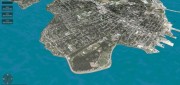
Mapping the Scottish Seabed
February 21, 2017
On land, surveyors face challenges due to rough terrain, human activity, weather, and more. Usually, however, the ground...
February 21, 2017
On land, surveyors face challenges due to rough terrain, human activity, weather, and more. Usually, however, the ground...

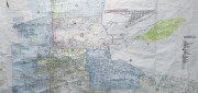
Mapping the Appalachian Trail (Part 2 of 2)
February 21, 2017
In 1998, the Appalachian Trail Conservancy (ATC) began its GIS program. Its first two challenges were to map the trail’s...
February 21, 2017
In 1998, the Appalachian Trail Conservancy (ATC) began its GIS program. Its first two challenges were to map the trail’s...

Comparing Maps a New Way
February 21, 2017
The positional accuracy of geospatial technologies has improved dramatically in the past few decades, and digital maps have...
February 21, 2017
The positional accuracy of geospatial technologies has improved dramatically in the past few decades, and digital maps have...

A Global Geodetic Roadmap
February 21, 2017
Geospatial technologies that have quickly become commonplace and essential in industrialized countries can be enormously...
February 21, 2017
Geospatial technologies that have quickly become commonplace and essential in industrialized countries can be enormously...
CLIVE: Communicating Risk in 3D
February 21, 2017
Static 3D models of topography and buildings are commonplace in both technical and popular geospatial software. There are still...
February 21, 2017
Static 3D models of topography and buildings are commonplace in both technical and popular geospatial software. There are still...