Geographic information systems

Stephen R.J. Sheppard: Collaborative Visualization to Advance Landscape Planning
April 15, 2012
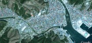
Recently the University of British Columbia unveiled The Decision Theatre, an interactive and immersive computer visualization...
April 15, 2012
Recently the University of British Columbia unveiled The Decision Theatre, an interactive and immersive computer visualization...
Google Earth Builder: Productizing Server Farms for Storing and Processing Geospatial Data
March 24, 2012
Google Earth Builder (GEB), which Google released last fall, enables private companies and government agencies to store and process...
March 24, 2012
Google Earth Builder (GEB), which Google released last fall, enables private companies and government agencies to store and process...

Mapping Application Makes Accurate Data Available in Real Time: Mobile GIS Helps Firefighters Respond More Effectively
June 1, 2010
For nearly a decade, the City of Marietta Fire Department in Georgia made do with a mapping application that was difficult...
June 1, 2010
For nearly a decade, the City of Marietta Fire Department in Georgia made do with a mapping application that was difficult...
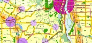
Portland, Oregon, Trailblazes a Successful Regional GIS
January 1, 2010
People from around the world come to Portland, Oregon, to study the city's successful model for growth management and comprehensive...
January 1, 2010
People from around the world come to Portland, Oregon, to study the city's successful model for growth management and comprehensive...