Apogeo Spatial
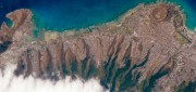
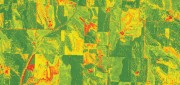
Companies Apply Machine Learning for Ag
March 6, 2018
The shift in the Earth observation (EO) market from selling pixels to selling finished intelligence products has sharply...
March 6, 2018
The shift in the Earth observation (EO) market from selling pixels to selling finished intelligence products has sharply...

Integrated UAV + Lidar Solutions
February 19, 2018
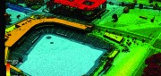
LiDAR has been around since the early 1960s. In recent years, it has emerged as a key geospatial remote sensing technology:...
February 19, 2018
LiDAR has been around since the early 1960s. In recent years, it has emerged as a key geospatial remote sensing technology:...
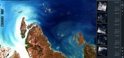
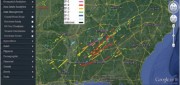
Geospatial Analytics-as-a-Service & Platforms
February 7, 2018
The field of Earth Observation (EO) has seen two big changes in recent years: first, the massive increase in the number and variety...
February 7, 2018
The field of Earth Observation (EO) has seen two big changes in recent years: first, the massive increase in the number and variety...

The Future of GPS
October 4, 2017
More than half a century after a study by The Aerospace Corporation first laid out the design options for it, the Global...
October 4, 2017
More than half a century after a study by The Aerospace Corporation first laid out the design options for it, the Global...
Open Source GEOSPATIAL SOFTWARE
October 4, 2017
Open source geospatial software—spatial data management, GIS, and related developer tools and end-user applications delivered...
October 4, 2017
Open source geospatial software—spatial data management, GIS, and related developer tools and end-user applications delivered...
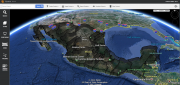
THE INSIDE STORY: Google Earth Enterprise Goes Open Source
August 4, 2017
On March 20, 2015, Google deprecated Google Earth Enterprise (GEE), which had contributed greatly to the market for geospatial...
August 4, 2017
On March 20, 2015, Google deprecated Google Earth Enterprise (GEE), which had contributed greatly to the market for geospatial...
FINAL ARTICLE IN THE SERIES on Geospatial Processing & Visualization: Ubisense and Harris Geospatial Solutions
August 4, 2017
The line between vendors of geospatial software and providers of geospatial data is increasingly blurred, as more companies...
August 4, 2017
The line between vendors of geospatial software and providers of geospatial data is increasingly blurred, as more companies...
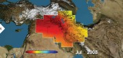
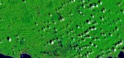
Satellite Missions Improve Water Estimates
April 28, 2017
Fresh water is humanity’s single most critical resource. According to a recent United Nations report, stresses on water...
April 28, 2017
Fresh water is humanity’s single most critical resource. According to a recent United Nations report, stresses on water...
Imagery Companies Become Information Companies
April 12, 2017
New analytics and the cloud benefit customers using the ultimate big data: imagery In the past few years, the number of space-based...
April 12, 2017
New analytics and the cloud benefit customers using the ultimate big data: imagery In the past few years, the number of space-based...
Building “Digital Earth”
February 23, 2017
A new generation of geospatial intelligence helps to answer complex geographic questions Paper maps obsolesce rapidly from...
February 23, 2017
A new generation of geospatial intelligence helps to answer complex geographic questions Paper maps obsolesce rapidly from...