Feature articles
Integrating photonic chips for better performance
October 12, 2020
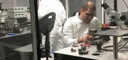
In June, KVH Industries launched the P-1775 inertial measurement unit (IMU), featuring its new PIC Inside photonic integrated...
October 12, 2020
In June, KVH Industries launched the P-1775 inertial measurement unit (IMU), featuring its new PIC Inside photonic integrated...
Riding Earth’s magnetism: An alternative approach to PNT
October 12, 2020
There are many ways to navigate. For most applications, none surpass the accuracy, affordability and convenience of satellite...
October 12, 2020
There are many ways to navigate. For most applications, none surpass the accuracy, affordability and convenience of satellite...

New players offering GNSS correction services
October 12, 2020
Thirty years ago, more than a decade before most people had even heard of GPS, receiver manufacturers and surveyors were...
October 12, 2020
Thirty years ago, more than a decade before most people had even heard of GPS, receiver manufacturers and surveyors were...

Using contact tracing and GPS to fight spread of COVID-19
October 11, 2020
Contact tracing can help stem the spread of the COVID-19 pandemic. It involves tracking the movement and interactions of infected...
October 11, 2020
Contact tracing can help stem the spread of the COVID-19 pandemic. It involves tracking the movement and interactions of infected...
WarLoc Equips Foot Soldiers
October 11, 2020
A new system, called WarLoc, makes it possible to locate warfighters and first responders in GPS-denied environments. Created...
October 11, 2020
A new system, called WarLoc, makes it possible to locate warfighters and first responders in GPS-denied environments. Created...

Leading the Way for Trucks
October 11, 2020
In the United States, trucking companies and the Army are both developing systems to automate moving groups of trucks. While...
October 11, 2020
In the United States, trucking companies and the Army are both developing systems to automate moving groups of trucks. While...

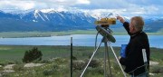
Lay of the Land
October 1, 2020
GPS receivers have been evolving steadily ever since the very first one was made by RockwellCollins in 1977, which was six feet...
October 1, 2020
GPS receivers have been evolving steadily ever since the very first one was made by RockwellCollins in 1977, which was six feet...
Shining Light on the Past
October 1, 2020
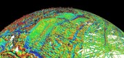
The collection of about 300 giant geoglyphs known as Nasca Lines were etched into the ground in the Peruvian coastal plain...
October 1, 2020
The collection of about 300 giant geoglyphs known as Nasca Lines were etched into the ground in the Peruvian coastal plain...

Precision agriculture grows with RTK
October 1, 2020
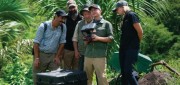
Precision agriculture — the practice of optimizing inputs of seed, water, and fertilizers while maximizing yields by mapping...
October 1, 2020
Precision agriculture — the practice of optimizing inputs of seed, water, and fertilizers while maximizing yields by mapping...
Antennas alert: Manufacturers discuss challenges and innovations
October 1, 2020
While often an underestimated component of a positioning and navigation system, a GNSS antenna is critical to a receiver’s...
October 1, 2020
While often an underestimated component of a positioning and navigation system, a GNSS antenna is critical to a receiver’s...