CAD

Not Everything Requires High Accuracies
November 6, 2018
How feature inspection, assessment, and reporting are now available to non-experts (and experts alike). In the early 2000s,...
November 6, 2018
How feature inspection, assessment, and reporting are now available to non-experts (and experts alike). In the early 2000s,...
The iCon build: Adding Adaptable Options for Layout Automation
June 29, 2017
At CONEXPO 2017, we were given a demonstration of one tool in the new wave of automated layout solutions for vertical...
June 29, 2017
At CONEXPO 2017, we were given a demonstration of one tool in the new wave of automated layout solutions for vertical...

Project Management, Collaboration, the Cloud, and Robots!
April 12, 2017
Trimble launches a new solution for construction project management– and takes a futuristic leap into autonomous construction...
April 12, 2017
Trimble launches a new solution for construction project management– and takes a futuristic leap into autonomous construction...
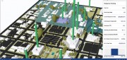
A State Gets Smart: SmarterBetterCities
February 21, 2017
To help formulate a 10-year strategic capital investment plan for the State of Oregon, the state’s Chief Financial Office...
February 21, 2017
To help formulate a 10-year strategic capital investment plan for the State of Oregon, the state’s Chief Financial Office...

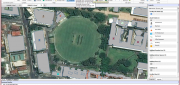
Capturing the Bluestone Dam
February 21, 2017
The Bluestone Damon the New River in West Virginia was completed in 1952. It’s 165 feet high above the stream bed and about...
February 21, 2017
The Bluestone Damon the New River in West Virginia was completed in 1952. It’s 165 feet high above the stream bed and about...
Automating the Mundane
January 19, 2017
You don’t have to work for huge organizations, such as the U.S. Air Force or the U.S. Forest Service, to appreciate the benefits...
January 19, 2017
You don’t have to work for huge organizations, such as the U.S. Air Force or the U.S. Forest Service, to appreciate the benefits...

3D Software, Not Really Like CAD at All
December 1, 2016
Editor’s note: For many firms and practitioners of surveying, photogrammetry, mapping, and remote sensing, traditional...
December 1, 2016
Editor’s note: For many firms and practitioners of surveying, photogrammetry, mapping, and remote sensing, traditional...

Geospatial Solutions: from PIXIA, Luciad, and BAE Systems
October 10, 2016
This series began a year ago by examining alternatives to Google Earth Enterprise, which Google will stop supporting on March...
October 10, 2016
This series began a year ago by examining alternatives to Google Earth Enterprise, which Google will stop supporting on March...
The Vanishing Divide: New solutions bridge the gap between CAD and GIS.
January 19, 2016
For decades, computer-aided design (CAD) and geographic information systems (GIS) have been like oil and water. CAD users,...
January 19, 2016
For decades, computer-aided design (CAD) and geographic information systems (GIS) have been like oil and water. CAD users,...