Building Information Modeling (BIM)
The iCon build: Adding Adaptable Options for Layout Automation
June 29, 2017
At CONEXPO 2017, we were given a demonstration of one tool in the new wave of automated layout solutions for vertical...
June 29, 2017
At CONEXPO 2017, we were given a demonstration of one tool in the new wave of automated layout solutions for vertical...

Project Management, Collaboration, the Cloud, and Robots!
April 12, 2017
Trimble launches a new solution for construction project management– and takes a futuristic leap into autonomous construction...
April 12, 2017
Trimble launches a new solution for construction project management– and takes a futuristic leap into autonomous construction...
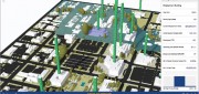
A State Gets Smart: SmarterBetterCities
February 21, 2017
To help formulate a 10-year strategic capital investment plan for the State of Oregon, the state’s Chief Financial Office...
February 21, 2017
To help formulate a 10-year strategic capital investment plan for the State of Oregon, the state’s Chief Financial Office...

Automating the Mundane
January 19, 2017
You don’t have to work for huge organizations, such as the U.S. Air Force or the U.S. Forest Service, to appreciate the benefits...
January 19, 2017
You don’t have to work for huge organizations, such as the U.S. Air Force or the U.S. Forest Service, to appreciate the benefits...

The Process of BIM
May 16, 2016
An analysis of Autodesk’s software suite, BIM 360, reveals how BIM can give project stakeholders unique access and insight...
May 16, 2016
An analysis of Autodesk’s software suite, BIM 360, reveals how BIM can give project stakeholders unique access and insight...