- Home
- About
- Topics
- 3D imaging
- Aerial photography
- Bathymetry
- Building Information Modeling (BIM)
- CAD
- Energy
- Cadaster
- Environment
- Geodesy
- GIS
- LiDAR
- Mapping
- Navigation
- Open source software
- Other
- Photogrammetry
- Precision agriculture
- Radar
- Remote sensing
- Satellite imaging
- Satellite navigation
- Seismology
- Sensors
- Surveying
- UAS
- Tracking
- Magazines
- Formats
- All
- Clients
- Tips
- Contact Us
Riding Earth’s magnetism: An alternative approach to PNT
Posted by: Matteo
Tags:
Posted date:
October 12, 2020 |
No comment

There are many ways to navigate. For most applications, none surpass the accuracy, affordability and convenience of satellite navigation.
However, given the threats to GNSS from spoofing and jamming, and the possibility that GNSS satellites could be destroyed accidentally by space debris or intentionally during a war, the search is on for alternative sources of positioning, navigation and timing (PNT) data.
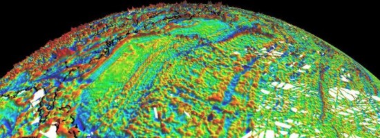
Potential alternative PNT (APNT) approaches include computer vision, terrain contour matching (TERCOM, which was used to guide cruise missiles in the 1970s and 1980s), and using magnetic anomalies (MAGNAV).
Copyright (c) 2012 by Pale Blue Dot, LLC / For information write to matteo@palebluedotllc.com
