• Home
  • About
    • About PBD
    • What Are Geospatial Technologies?
    • Matteo Luccio’s Bio
    • Conferences
    • Our Name
  • Topics
    • 3D imaging
    • Aerial photography
    • Bathymetry
    • Building Information Modeling (BIM)
    • CAD
    • Energy
    • Cadaster
    • Environment
    • Geodesy
    • GIS
    • LiDAR
    • Mapping
    • Navigation
    • Open source software
    • Other
    • Photogrammetry
    • Precision agriculture
    • Radar
    • Remote sensing
    • Satellite imaging
    • Satellite navigation
    • Seismology
    • Sensors
    • Surveying
    • UAS
    • Tracking
  • Magazines
    • Apogeo Spatial
    • ArcNews
    • ArcWatch
    • CE News
    • Earth Imaging Journal
    • GEOInformatics
    • GeoWorld
    • GIM International
    • Heights
    • Informed Infrastruct.
    • Imaging Notes
    • Point of Beginning
    • Prof. Surveyor Mag.
    • Sensors & Systems
    • Septentrio Insights
    • The American Surveyor
    • xyHt
  • Formats
    • Feature articles
    • Short articles
    • Interviews
    • News items
    • Other
  • All
  • Clients
  • Tips
    • Gripes
    • Tips
  • Contact Us
 

Integrating photonic chips for better performance

Posted by: Matteo    Tags:      Posted date:  October 12, 2020  |  No comment


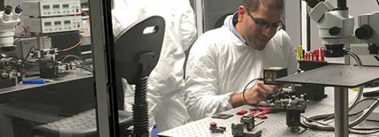
In June, KVH Industries launched the P-1775 inertial measurement unit (IMU), featuring its new PIC Inside photonic integrated chip (PIC) technology.

After developing and testing the technology for more than three years, the company began incorporating it into existing product lines and has shipped the first units.

The PIC technology features an integrated planar optical chip that replaces individual fiber-optic components to simplify production while maintaining or improving accuracy and performance.

Read More…


Want to say something?


  Cancel Reply


four × = 36

« Riding Earth’s magnetism: An alternative approach to PNT


Copyright (c) 2012 by Pale Blue Dot, LLC / For information write to matteo@palebluedotllc.com