Feature articles
Imagery Companies Become Information Companies
April 12, 2017
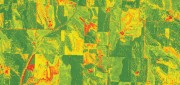
New analytics and the cloud benefit customers using the ultimate big data: imagery In the past few years, the number of space-based...
April 12, 2017
New analytics and the cloud benefit customers using the ultimate big data: imagery In the past few years, the number of space-based...

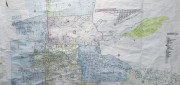
Cadasta: Mapping Land Rights from the Bottom Up
April 12, 2017
Cadasta helps put people on the map with a cloud-based platform for land-ownership data. In advanced industrial countries...
April 12, 2017
Cadasta helps put people on the map with a cloud-based platform for land-ownership data. In advanced industrial countries...

Project Management, Collaboration, the Cloud, and Robots!
April 12, 2017
Trimble launches a new solution for construction project management– and takes a futuristic leap into autonomous construction...
April 12, 2017
Trimble launches a new solution for construction project management– and takes a futuristic leap into autonomous construction...

GNSS Mission: Accomplished
April 12, 2017
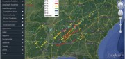
Editor’s note: So rarely do new major players arise in the high-precision GNSS industry that we feel the following to be a significant...
April 12, 2017
Editor’s note: So rarely do new major players arise in the high-precision GNSS industry that we feel the following to be a significant...
Building “Digital Earth”
February 23, 2017
A new generation of geospatial intelligence helps to answer complex geographic questions Paper maps obsolesce rapidly from...
February 23, 2017
A new generation of geospatial intelligence helps to answer complex geographic questions Paper maps obsolesce rapidly from...

LIDAR Is Key To Autonomous Vehicles
February 23, 2017
Technology for autonomous vehicles builds on car navigation systems that have been commonplace for years and new collision-avoidance...
February 23, 2017
Technology for autonomous vehicles builds on car navigation systems that have been commonplace for years and new collision-avoidance...
Championing GNSS for Surveyors
February 21, 2017
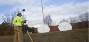
Lonnie Sears’ passion for surveying began when he took a surveying class while studying engineering at West Virginia Tech....
February 21, 2017
Lonnie Sears’ passion for surveying began when he took a surveying class while studying engineering at West Virginia Tech....
A State Gets Smart: SmarterBetterCities
February 21, 2017
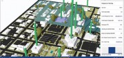
To help formulate a 10-year strategic capital investment plan for the State of Oregon, the state’s Chief Financial Office...
February 21, 2017
To help formulate a 10-year strategic capital investment plan for the State of Oregon, the state’s Chief Financial Office...
Geospatial PPPs
February 21, 2017
Land ownership is a foundation of national economies: those who have land titles can use them to obtain credit (which is often...
February 21, 2017
Land ownership is a foundation of national economies: those who have land titles can use them to obtain credit (which is often...

Mapping the Scottish Seabed
February 21, 2017
On land, surveyors face challenges due to rough terrain, human activity, weather, and more. Usually, however, the ground...
February 21, 2017
On land, surveyors face challenges due to rough terrain, human activity, weather, and more. Usually, however, the ground...