Geographic information systems
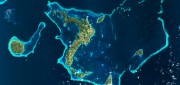
Wetlands Worth their Weight
March 2, 2016
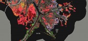
"Wetland" is a generic term covering a wide variety of habitats that are wet for at least some period of time each year,...
March 2, 2016
"Wetland" is a generic term covering a wide variety of habitats that are wet for at least some period of time each year,...
The Vanishing Divide: New solutions bridge the gap between CAD and GIS.
January 19, 2016
For decades, computer-aided design (CAD) and geographic information systems (GIS) have been like oil and water. CAD users,...
January 19, 2016
For decades, computer-aided design (CAD) and geographic information systems (GIS) have been like oil and water. CAD users,...
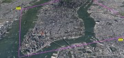
The Demise of Google Earth Enterprise: VRICON AND ARCGIS EARTH FILL THE GAP
December 28, 2015
Google is ending a 10-year run of Google Earth Enterprise (GEE), which contributed greatly to the market for geospatial “Digital...
December 28, 2015
Google is ending a 10-year run of Google Earth Enterprise (GEE), which contributed greatly to the market for geospatial “Digital...
Mapping the Appalachian Trail (Part 1 of 2)
May 26, 2015
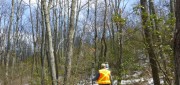
How the AT was created and surveyed, from Avery’s wheel to GPS The Appalachian Trail (AT) is very old, very long, and iconic....
May 26, 2015
How the AT was created and surveyed, from Avery’s wheel to GPS The Appalachian Trail (AT) is very old, very long, and iconic....
Navigating Without Addresses
April 10, 2015
New codes aim to bring billions of people into the geospatial market When we mail a letter to an address in an industrialized...
April 10, 2015
New codes aim to bring billions of people into the geospatial market When we mail a letter to an address in an industrialized...
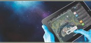
Developing the Map of the Future
April 9, 2015
Geospatial technology is changing. Now geographic information system (GIS) software is ingesting, organizing and visualizing...
April 9, 2015
Geospatial technology is changing. Now geographic information system (GIS) software is ingesting, organizing and visualizing...

Real-Time Monitoring A Hit Down Under
January 11, 2015
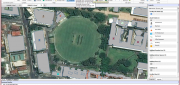
In the heart of Brisbane, Australia’s third most populous city, constructioncompany Watpac Australia Pty. Ltd. has a contract...
January 11, 2015
In the heart of Brisbane, Australia’s third most populous city, constructioncompany Watpac Australia Pty. Ltd. has a contract...
Imagery Options for Esri Users. Esri’s ArcGIS Marketplace
December 29, 2014
IS users increasingly expect content to come with their platform, rather than be an add-on. To help meet this expectation,...
December 29, 2014
IS users increasingly expect content to come with their platform, rather than be an add-on. To help meet this expectation,...

Satellite Signals Steer Farmers Straight
December 29, 2014
Precision agriculture combines GPS, remote sensing, and GIS to capture large amounts of georeferenced data on spatial variations...
December 29, 2014
Precision agriculture combines GPS, remote sensing, and GIS to capture large amounts of georeferenced data on spatial variations...
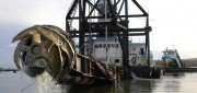
Survey. Dredge. Repeat. Keeping the Columbia River Navigable
December 29, 2014
As the skipper of Galileo 3, a 30-foot sailboat on the Columbia River, I tell my crew that I am comfortable with 15 feet...
December 29, 2014
As the skipper of Galileo 3, a 30-foot sailboat on the Columbia River, I tell my crew that I am comfortable with 15 feet...