xyHt

CLIVE: Communicating Risk in 3D
February 21, 2017
Static 3D models of topography and buildings are commonplace in both technical and popular geospatial software. There are still...
February 21, 2017
Static 3D models of topography and buildings are commonplace in both technical and popular geospatial software. There are still...

Capturing the Bluestone Dam
February 21, 2017
The Bluestone Damon the New River in West Virginia was completed in 1952. It’s 165 feet high above the stream bed and about...
February 21, 2017
The Bluestone Damon the New River in West Virginia was completed in 1952. It’s 165 feet high above the stream bed and about...
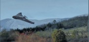
Surveying a Mountain Highway with UAS
February 21, 2017
In the steep canyons of the Republic of Macedonia, AKTOR ADT, an international construction company based in Athens, Greece,...
February 21, 2017
In the steep canyons of the Republic of Macedonia, AKTOR ADT, an international construction company based in Athens, Greece,...
Automating the Mundane
January 19, 2017
You don’t have to work for huge organizations, such as the U.S. Air Force or the U.S. Forest Service, to appreciate the benefits...
January 19, 2017
You don’t have to work for huge organizations, such as the U.S. Air Force or the U.S. Forest Service, to appreciate the benefits...

Custom, Portable Maps — Via App!
December 12, 2016
Avenza has evolved its map products into an app that lets people upload their own map—or download a map of their choice—to...
December 12, 2016
Avenza has evolved its map products into an app that lets people upload their own map—or download a map of their choice—to...

3D Software, Not Really Like CAD at All
December 1, 2016
Editor’s note: For many firms and practitioners of surveying, photogrammetry, mapping, and remote sensing, traditional...
December 1, 2016
Editor’s note: For many firms and practitioners of surveying, photogrammetry, mapping, and remote sensing, traditional...
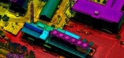
A Lidar That Oversamples: Geiger Lidar Imaging
October 10, 2016
Typical linear lidar systems repeatedly fire a single beam, each time measuring a single location on the ground. They collect...
October 10, 2016
Typical linear lidar systems repeatedly fire a single beam, each time measuring a single location on the ground. They collect...
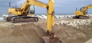
Moving Dirt Just Right
August 30, 2016
GNSS receivers help steer earth movers, providing users with accurate positions and no complexities. NavCom–a wholly owned...
August 30, 2016
GNSS receivers help steer earth movers, providing users with accurate positions and no complexities. NavCom–a wholly owned...

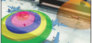
Space Engineer In Training
June 2, 2016
Last summer, NASA dropped three small airplanes from 100 feet in tests meant to simulate severe but survivable crashes. It collected...
June 2, 2016
Last summer, NASA dropped three small airplanes from 100 feet in tests meant to simulate severe but survivable crashes. It collected...

The Process of BIM
May 16, 2016
An analysis of Autodesk’s software suite, BIM 360, reveals how BIM can give project stakeholders unique access and insight...
May 16, 2016
An analysis of Autodesk’s software suite, BIM 360, reveals how BIM can give project stakeholders unique access and insight...